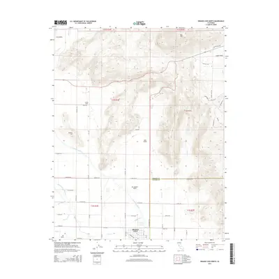
2015 Map of Orange Cove North
USGS Topo · Published 2015About this map
Orange Cove anchors this landscape where the floor of the San Joaquin Valley meets the rising foothills. The map reveals an intricate network of water management essential to the region's agricultural character, dominated by the sweeping curve of the Friant-Kern Canal and supplemented by the Alta East Branch Canal, Miller Ditch, and Alta W Clark Ditch. These man-made waterways contrast with natural drainages like Wahtoke Creek and Wooten Creek. To the north and east, the terrain climbs toward Bear Mountain and Granite Hill, framing the distinct lowlands of Clark Valley, Hills Valley, and Squaw Valley. This 2015 survey shows a grid of rural avenues and roads like Jensen Avenue and Adams Avenue that connect the main township with smaller settlements such as Citrus Cove and the site of Mt Olive, illustrating the persistent footprint of Central Valley citrus culture.
Find a feature on this map
57 named features on this map. Tap any name to fly to it.
Don’t see what you’re looking for? This feature index may not catch every label — zoom into the map to look around manually.
Map Details
Editions of this 2015 Orange Cove North Map
This is the sole edition of this map. No revisions or reprints were ever made.
Other maps of this area

1920 · Orangedale School
USGS Topo · 1:24,000

1921 · Squaw Valley
USGS Topo · 1:31,680

1921 · Stokes Mountain
USGS Topo · 1:24,000

1922 · Trimmer
USGS Topo · 1:96,000

1923 · Sultana
USGS Topo · 1:31,680

1923 · Orangedale School
USGS Topo · 1:31,680

1923 · Wahtoke
USGS Topo · 1:31,680

1924 · Reedley
USGS Topo · 1:31,680

1924 · Citrus Cove
USGS Topo · 1:31,680

1924 · Dinuba
USGS Topo · 1:125,000