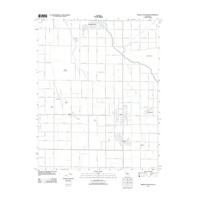
2012 Map of Orange Cove South
USGS Topo · Published 2012About this map
Orosi and Cutler anchor this San Joaquin Valley landscape, where an intricate network of irrigation and infrastructure supported a dense agricultural corridor in the early 21st century. The map reveals the engineering behind the region's productivity, dominated by the massive Friant-Kern Canal and supplemented by the Alta E Br Canal, the Bump and Edmiston Ditch, and Sand Creek. Smaller settlements like Sultana, Tokay, and Wyeth are scattered throughout the grid of rural roads, including Monson Avenue and Road 104. Local history is preserved at the Smith Mountain Cemetery at the foot of Barris Hill, while the Alta Airport highlights the area's logistical connections. Prominent geological features like Smith Mountain and Curtis Mountain rise above the orchard-lined flats, providing clear orientation points for this deeply transformed environment.
Find a feature on this map
82 named features on this map. Tap any name to fly to it.
Don’t see what you’re looking for? This feature index may not catch every label — zoom into the map to look around manually.
Map Details
Editions of this 2012 Orange Cove South Map
This is the sole edition of this map. No revisions or reprints were ever made.
Other maps of this area

1921 · Squaw Valley
USGS Topo · 1:31,680

1921 · Stokes Mountain
USGS Topo · 1:24,000

1922 · Trimmer
USGS Topo · 1:96,000

1923 · Sultana
USGS Topo · 1:31,680

1923 · Wahtoke
USGS Topo · 1:31,680

1924 · Reedley
USGS Topo · 1:31,680

1924 · Citrus Cove
USGS Topo · 1:31,680

1924 · Dinuba
USGS Topo · 1:125,000

1924 · Stokes Mountain
USGS Topo · 1:31,680

1926 · Ivanhoe
USGS Topo · 1:31,680