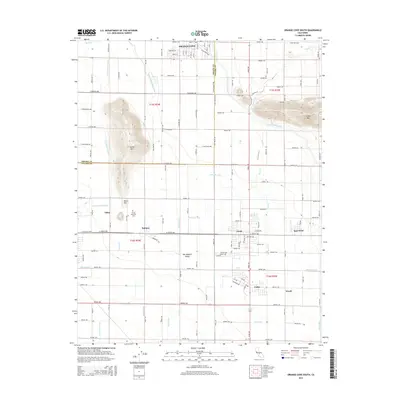
2015 Map of Orange Cove South
USGS Topo · Published 2015About this map
The San Joaquin Valley landscape across the Fresno and Tulare county line is defined by its extensive network of irrigation canals and agriculture-focused settlements. Orange Cove anchors the northern edge of this 2015 study, while the southern half is densely packed with the unincorporated communities of Orosi, East Orosi, Cutler, and Sultana. This region’s topography is largely flat, broken only by prominent elevations like Smith Mtn, where the Smith Mountain Cemetery is located, and Curtis Mtn to the east.
Find a feature on this map
81 named features on this map. Tap any name to fly to it.
Don’t see what you’re looking for? This feature index may not catch every label — zoom into the map to look around manually.
Map Details
Editions of this 2015 Orange Cove South Map
This is the sole edition of this map. No revisions or reprints were ever made.
Other maps of this area

1921 · Squaw Valley
USGS Topo · 1:31,680

1921 · Stokes Mountain
USGS Topo · 1:24,000

1922 · Trimmer
USGS Topo · 1:96,000

1923 · Sultana
USGS Topo · 1:31,680

1923 · Wahtoke
USGS Topo · 1:31,680

1924 · Reedley
USGS Topo · 1:31,680

1924 · Citrus Cove
USGS Topo · 1:31,680

1924 · Dinuba
USGS Topo · 1:125,000

1924 · Stokes Mountain
USGS Topo · 1:31,680

1926 · Ivanhoe
USGS Topo · 1:31,680