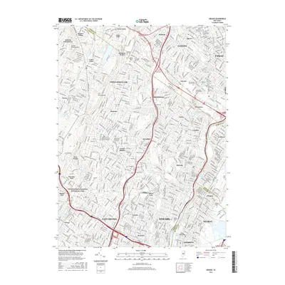
2016 Map of Orange
USGS Topo · Published 2016About this map
The urban and industrial corridor of Essex and Passaic Counties is centered here, anchored by the laboratory grounds at Thomas Edison National Historical Park. This densely developed landscape is defined by the winding course of the Passaic River and its varied reaches, including the Nutley Reach and Belleville Reach. The map illustrates the residential and commercial evolution of suburban communities like Montclair, Bloomfield, and Glen Ridge, where street grids transition into the elevation of the First Watchung Mtn and Second Watchung Mtn.
Find a feature on this map
83 named features on this map. Tap any name to fly to it.
Don’t see what you’re looking for? This feature index may not catch every label — zoom into the map to look around manually.
Map Details
Editions of this 2016 Orange Map
This is the sole edition of this map. No revisions or reprints were ever made.
Other maps of this area

1888 · Plainfield
USGS Topo · 1:62,500

1888 · Morristown
USGS Topo · 1:62,500

1888 · Paterson
USGS Topo · 1:62,500

1892 · Paterson
USGS Topo · 1:62,500

1893 · Plainfield
USGS Topo · 1:62,500

1894 · Morristown
USGS Topo · 1:62,500

1898 · Morristown
USGS Topo · 1:62,500

1898 · Plainfield
USGS Topo · 1:62,500

1898 · Staten Island
USGS Topo · 1:62,500

1898 · Paterson
USGS Topo · 1:62,500