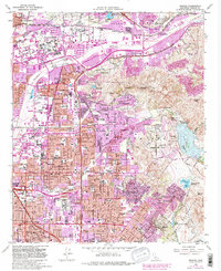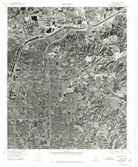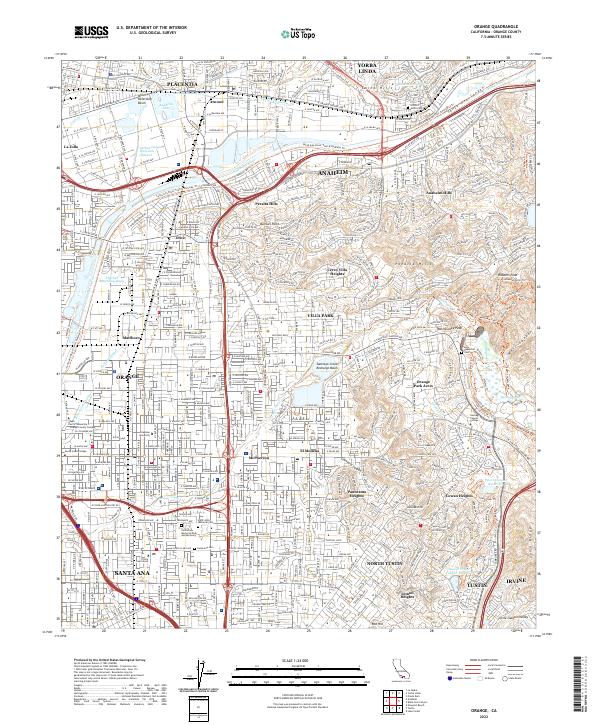
2022 Map of Orange
USGS Topo · Published 2022About this map
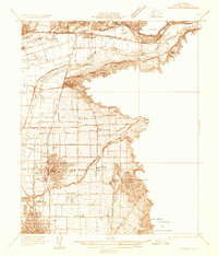
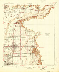
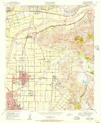
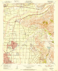
Anaheim and Orange form the urban core of this 2022 survey, reflecting the dense development of central Orange County. The landscape is heavily defined by sophisticated water management systems, including the Santiago Creek Recharge Basin, Anaheim Lake, and the Fletcher Retarding Basin, which capture runoff from the Santa Ana River and Santiago Creek. To the east, the terrain rises into the Peralta Hills and Anaheim Hills, where suburban neighborhoods meet protected canyons like Weir Canyon. Local history and genealogy are anchored by several significant sites, notably the Historic Yorba Cem near the river and the expansive Fairhaven Memorial Park and Mortuary in Santa Ana. Academic institutions like Chapman University and Santiago Canyon College are prominent landmarks within their respective communities. This map documents a modern landscape where residential growth and essential hydrologic infrastructure are inextricably linked.
Find a feature on this map
69 named features on this map. Tap any name to fly to it.
Don’t see what you’re looking for? This feature index may not catch every label — zoom into the map to look around manually.
Map Details
Editions of this 2022 Orange Map
This is the sole edition of this map. No revisions or reprints were ever made.
Historical Maps of Yorba Linda Through Time
7 maps found