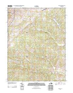
2013 Map of Orange
USGS Topo · Published 2013About this map
The town of Orange anchors the northern reaches of this Virginia survey, situated near the headwaters of the Rapidan River. The surrounding landscape is defined by its complex hydrography, where the N Anna River flows toward the southeast near Vawter Corner and Brocks Bridge. Numerous smaller waterways like Tomahawk Cr, Cooks Cr, and Pamunkey Cr carve through the terrain, supporting local landmarks such as Lake Orange and J E Taylor Lake.
Find a feature on this map
119 named features on this map. Tap any name to fly to it.
Don’t see what you’re looking for? This feature index may not catch every label — zoom into the map to look around manually.
Map Details
Editions of this 2013 Orange Map
This is the sole edition of this map. No revisions or reprints were ever made.
Other maps of this area

1887 · Spottsylvania
USGS Topo · 1:125,000

1892 · Spottsylvania
USGS Topo · 1:125,000

1892 · Gordonsville
USGS Topo · 1:125,000

1942 · Mineral
USGS Topo · 1:31,680

1942 · Lahore
USGS Topo · 1:31,680

1943 · Unionville
USGS Topo · 1:24,000
1944 · Unionville
USGS Topo · 1:31,680

1948 · Washington
USGS Topo · 1:250,000

1949 · Charlottesville
USGS Topo · 1:250,000

1956 · Charlottesville
USGS Topo · 1:250,000