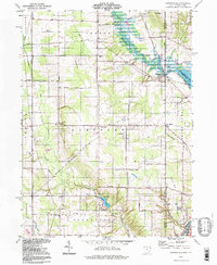
1994 Map of Orangeville
USGS Topo · Published 1997About this map
Orangeville and the surrounding borderlands of Trumbull County, Ohio, and Mercer County, Pennsylvania, are defined by a mix of agricultural tracts and water-driven geography. In the 1990s, the landscape around Hartford and Burghill retained its rural character, anchored by historic family-named burial sites such as Atherholt Cem and Burghill Cem. The course of Pymatuning Creek winds through the valley, eventually meeting the Shenango River near the state line, while Yankee Lake serves as a prominent local water feature to the south.
Find a feature on this map
50 named features on this map. Tap any name to fly to it.
Don’t see what you’re looking for? This feature index may not catch every label — zoom into the map to look around manually.
Map Details
Editions of this 1994 Orangeville Map
This is the sole edition of this map. No revisions or reprints were ever made.
Other maps of this area

1905 · Neshannock
USGS Topo · 1:62,500

1906 · Youngstown
USGS Topo · 1:62,500

1907 · Neshannock
USGS Topo · 1:62,500

1907 · Kinsman
USGS Topo · 1:62,500

1908 · Shenango
USGS Topo · 1:62,500

1908 · Youngstown
USGS Topo · 1:62,500

1950 · Cleveland
USGS Topo · 1:250,000

1954 · Sharon West
USGS Topo · 1:24,000

1954 · Girard
USGS Topo · 1:24,000

1956 · Cleveland
USGS Topo · 1:250,000