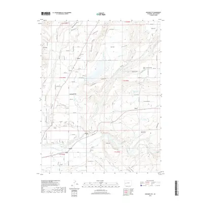
2019 Map of Orchard City
USGS Topo · Published 2019About this map
Orchard City serves as the central hub of this Delta County landscape, where the high mesas of Doctor Mesa and Cedar Mesa overlook a valley defined by an intricate network of irrigation and agriculture. The reliance on water management is evident in the dense system of ditches and laterals, including the Highline Ditch, Alfalfa Ditch, and Bona Fide Ditch, which sustain the local orchards and farms. Small rural settlements like Eckert, Austin, and Cory are scattered throughout the region, each anchored by its own community space such as the Eckert Cem or Cory Cem. Along the southern edge, the Gunnison River carves through the terrain near Saxton, providing a natural boundary and vital water source. This 2019 survey documents the enduring agricultural character of the area, from the small landing strips at Widner Airport to the livestock-supporting drainages of Posin Gulch and Madison Gulch.
Find a feature on this map
97 named features on this map. Tap any name to fly to it.
Don’t see what you’re looking for? This feature index may not catch every label — zoom into the map to look around manually.
Map Details
Editions of this 2019 Orchard City Map
This is the sole edition of this map. No revisions or reprints were ever made.
Other maps of this area

1955 · Olathe NW
USGS Topo · 1:24,000

1955 · Black Ridge
USGS Topo · 1:24,000

1955 · Lazear
USGS Topo · 1:24,000

1956 · Montrose
USGS Topo · 1:250,000

1956 · Moab
USGS Topo · 1:250,000

1959 · Moab
USGS Topo · 1:250,000

1959 · Montrose
USGS Topo · 1:250,000

1960 · Montrose
USGS Topo · 1:250,000

1960 · Moab
USGS Topo · 1:250,000

1962 · Moab
USGS Topo · 1:250,000