
1955 Map of Olathe NW
USGS Topo · Published 1956About this map
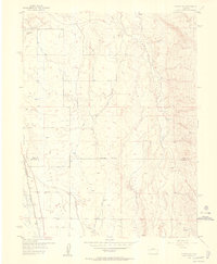
The Uncompahgre River corridor in Delta and Montrose counties is defined here by an extensive network of irrigation infrastructure and transport routes as seen in the mid-1950s. The western edge of the map follows the Denver and Rio Grande Western railroad line, which skirts the base of East Mesa. This landscape is marked by the heavy hand of water management, featuring the East Selig Canal, numerous siphons, flumes, and a Tunnel, all designed to bring water into the arid basin. To the east, Peach Valley contains several reservoirs, including Peach Valley Dam No 1, Lower Peach Valley Dam, and Middle Peach Valley Dam. Aviation history is represented by the Star Nelson Airport and the nearby VABM Airport 5270 marker, while more remote reaches are accessible only by a Jeep Trail along the foothills of Black Ridge.
Find a feature on this map
21 named features on this map. Tap any name to fly to it.
Don’t see what you’re looking for? This feature index may not catch every label — zoom into the map to look around manually.
Map Details
Editions of this 1955 Olathe NW Map
5 editions found
Other maps of this area

1955 · Black Ridge
USGS Topo · 1:24,000

1955 · Olathe
USGS Topo · 1:24,000

1955 · Red Rock Canyon
USGS Topo · 1:24,000

1955 · Lazear
USGS Topo · 1:24,000

1956 · Montrose
USGS Topo · 1:250,000

1956 · Moab
USGS Topo · 1:250,000

1959 · Moab
USGS Topo · 1:250,000

1959 · Montrose
USGS Topo · 1:250,000

1960 · Montrose
USGS Topo · 1:250,000

1960 · Moab
USGS Topo · 1:250,000