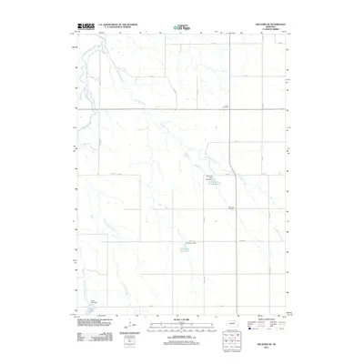
2011 Map of Orchard NE
USGS Topo · Published 2011About this map
Verdigre Creek and Merriman Creek wind through this rural landscape in Knox County, defining a region where water management and agriculture are central to the terrain. The 2011 survey illustrates a network of section roads and reservoirs, including the Rod and Gun Club Reservoir and Hanneman Reservoir, which emphasize local land use and recreational water engineering. For genealogists and local historians, the map identifies specific points of rest for early residents at the Alcott Cemetery in the north and the Millerboro Cemetery further south. The southwestern corner is dominated by the waters of Grove Lake, held by the Grove Lake Dam, where the East Branch Verdigre Creek joins the primary waterway. This topographical record provides a clear look at the sparsely populated rural infrastructure of Nebraska at the start of the 21st century.
Find a feature on this map
26 named features on this map. Tap any name to fly to it.
Don’t see what you’re looking for? This feature index may not catch every label — zoom into the map to look around manually.
Map Details
Editions of this 2011 Orchard NE Map
This is the sole edition of this map. No revisions or reprints were ever made.
Other maps of this area

1954 · Walnut
USGS Topo · 1:24,000

1954 · Verdigre
USGS Topo · 1:24,000

1955 · Sioux City
USGS Topo · 1:250,000

1955 · O'Neill
USGS Topo · 1:250,000

1958 · Sioux City
USGS Topo · 1:250,000

1959 · O'Neill
USGS Topo · 1:250,000

1959 · Sioux City
USGS Topo · 1:250,000

1963 · Orchard NE
USGS Topo · 1:24,000

1963 · Brunswick
USGS Topo · 1:24,000

1963 · Royal
USGS Topo · 1:24,000