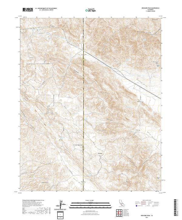
2021 Map of Orchard Peak
USGS Topo · Published 2021About this map
Annette sits near the crossing of Annette Rd and Bitterwater Rd, serving as a focal point for this high-elevation landscape where San Luis Obispo and Kern counties meet. The terrain is defined by the steep rises of the Diablo Range, culminating at Orchard Peak and the prominent Bluestone Ridge. This 2021 survey shows a complex network of canyons and valleys, including Choice Valley and Antelope Valley, which are connected by critical transit points like Polonio Pass and Palo Prieto Pass. The modern industrial footprint of the Governor Edmund G Brown Coastal Br California Aqueduct cuts across the northern slopes, providing a stark contrast to the scattered natural springs and seasonal bodies of water such as Twisselmann Lake and Poison Water Pond. Local landmarks like McGovern Gap and Hilbrich Grade trace the legacy of travel through these mountain corridors.
Find a feature on this map
46 named features on this map. Tap any name to fly to it.
Don’t see what you’re looking for? This feature index may not catch every label — zoom into the map to look around manually.
Map Details
Editions of this 2021 Orchard Peak Map
This is the sole edition of this map. No revisions or reprints were ever made.
Other maps of this area

1914 · Cholame
USGS Topo · 1:125,000

1915 · Cholame
USGS Topo · 1:125,000

1917 · Cholame
USGS Topo · 1:125,000

1942 · Tent Hills
USGS Topo · 1:24,000

1943 · Packwood
USGS Topo · 1:31,680

1943 · Grant Lake
USGS Topo · 1:31,680

1943 · Commatti Canyon
USGS Topo · 1:31,680
1943 · Cholame
USGS Topo · 1:31,680
1943 · Tent Hills
USGS Topo · 1:31,680
1943 · Sawtooth Ridge
USGS Topo · 1:31,680