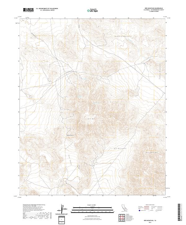
2021 Map of Ord Mountain
USGS Topo · Published 2021About this map
The Ord Mtn peak and the surrounding Ord Mountains dominate this high-desert landscape in the Mojave Desert. This terrain is defined by its vital water sources, with several named springs clustered around the mountain slopes, including Aztec Spring, Sweetwater Spring, and Willow Spring. These points would have been critical landmarks for travelers and early inhabitants traversing the arid reaches of the Tyler Valley.
Find a feature on this map
18 named features on this map. Tap any name to fly to it.
Don’t see what you’re looking for? This feature index may not catch every label — zoom into the map to look around manually.
Map Details
Editions of this 2021 Ord Mountain Map
This is the sole edition of this map. No revisions or reprints were ever made.
Other maps of this area

1953 · San Bernardino
USGS Topo · 1:250,000

1955 · Newberry
USGS Topo · 1:62,500

1955 · Ord Mountains
USGS Topo · 1:62,500

1955 · Rodman Mountains
USGS Topo · 1:62,500

1956 · San Bernardino
USGS Topo · 1:250,000

1956 · Daggett
USGS Topo · 1:62,500

1957 · San Bernardino
USGS Topo · 1:250,000

1958 · San Bernardino
USGS Topo · 1:250,000

1959 · San Bernardino
USGS Topo · 1:250,000

1966 · San Bernardino
USGS Topo · 1:250,000