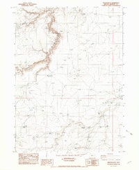
1982 Map of Oregon Butte
USGS Topo · Published 1983About this map
Oregon Butte stands as a prominent landmark in this high-desert portion of Malheur County, where the landscape is defined by deep drainages and scarce water sources. This 1982 field-checked survey reveals a network of isolated water improvements essential for land management, including Star Valley Reservoir, Jeff Reservoir, and Twin Buttes Reservoir. The presence of several named springs, such as Moonshine Spring, Cairn Spring, and Delma Spring, suggests the critical importance of these specific points for local livestock and wildlife in an otherwise arid environment. The map also documents a remote Landing Strip near Tent Creek, illustrating the reliance on light aircraft for accessing this corner of eastern Oregon. Deep incisions from the Louse River and Mossy Canyon cut through the volcanic plateaus, while long stretches of Fence lines trace the division of the open range.
Find a feature on this map
23 named features on this map. Tap any name to fly to it.
Don’t see what you’re looking for? This feature index may not catch every label — zoom into the map to look around manually.
Map Details
Editions of this 1982 Oregon Butte Map
This is the sole edition of this map. No revisions or reprints were ever made.
Other maps of this area

1882 · Paradise
USGS Topo · 1:250,000

1893 · Paradise
USGS Topo · 1:250,000

1955 · McDermitt
USGS Topo · 1:250,000

1955 · Jordan Valley
USGS Topo · 1:250,000

1957 · Jordan Valley
USGS Topo · 1:250,000

1958 · Jordan Valley
USGS Topo · 1:250,000

1959 · McDermitt
USGS Topo · 1:250,000

1980 · Odell Mountain
USGS Topo · 1:24,000

1980 · Calico Butte
USGS Topo · 1:24,000

1980 · Mahogany Spring
USGS Topo · 1:24,000