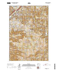
2020 Map of Oregon City
USGS Topo · Published 2020About this map
Oregon City stands as a pivotal point on this landscape, anchored by the Willamette River and the powerful Willamette Falls. The area includes several established communities such as Gladstone, West Linn, and Park Place, showing a dense network of suburban development and civic infrastructure including the Clackamas County Courthouse. A significant concentration of historical and genealogical sites is evident through a series of burial grounds, including Mountain View Cem, Masonic Cem, and the Independent Order of Odd Fellows Cem.
Find a feature on this map
229 named features on this map. Tap any name to fly to it.
Don’t see what you’re looking for? This feature index may not catch every label — zoom into the map to look around manually.
Map Details
Editions of this 2020 Oregon City Map
This is the sole edition of this map. No revisions or reprints were ever made.
Other maps of this area

1911 · Boring
USGS Topo · 1:48,000

1914 · Boring
USGS Topo · 1:62,500

1914 · Oregon City
USGS Topo · 1:62,500

1916 · Estacada
USGS Topo · 1:125,000

1939 · Molalla
USGS Topo · 1:62,500

1939 · Oregon City
USGS Topo · 1:62,500

1940 · Molalla
USGS Topo · 1:62,500

1940 · Boring
USGS Topo · 1:62,500

1941 · Oregon City
USGS Topo · 1:62,500

1948 · Vancouver
USGS Topo · 1:250,000