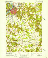
1954 Map of Oregon City
USGS Topo · Published 1956About this map
The Willamette River and its powerful Clackamas Rapids define this mid-century portrait of Oregon City and its surrounding hill country. At the confluence of the two rivers, the map reveals a complex landscape of industry and transportation, where the Southern Pacific and Portland Traction Co railroads navigate the steep riverbanks. The settlement patterns extend from the urban core of West Linn and Gladstone into the rural uplands, where family farms and community life center on local institutions like the Maple Lane Grange and the distinctively named Ten O'Clock Church.
Find a feature on this map
62 named features on this map. Tap any name to fly to it.
Don’t see what you’re looking for? This feature index may not catch every label — zoom into the map to look around manually.
Map Details
Editions of this 1954 Oregon City Map
This is the sole edition of this map. No revisions or reprints were ever made.
Other maps of this area

1911 · Boring
USGS Topo · 1:48,000

1914 · Boring
USGS Topo · 1:62,500

1914 · Oregon City
USGS Topo · 1:62,500

1916 · Estacada
USGS Topo · 1:125,000

1939 · Molalla
USGS Topo · 1:62,500

1939 · Oregon City
USGS Topo · 1:62,500

1940 · Molalla
USGS Topo · 1:62,500

1940 · Boring
USGS Topo · 1:62,500

1941 · Oregon City
USGS Topo · 1:62,500

1948 · Vancouver
USGS Topo · 1:250,000