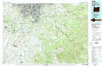
1982 Map of Oregon City
USGS Topo · Published 1983About this map
Oregon City and the surrounding Willamette Valley are captured here in the early 1980s, showcasing the dense intersection of river systems and suburban expansion. The Willamette River and Clackamas River serve as the primary geographic anchors, supporting a network of riverside communities from Milwaukie and Gladstone to the rural reaches of Canby. This period reflects the established industrial and military presence in the region, including Camp Withycombe and various active quarries.
Find a feature on this map
234 named features on this map. Tap any name to fly to it.
Don’t see what you’re looking for? This feature index may not catch every label — zoom into the map to look around manually.
Map Details
Editions of this 1982 Oregon City Map
This is the sole edition of this map. No revisions or reprints were ever made.
Other maps of this area

1897 · Portland
USGS Topo · 1:62,500

1905 · Portland
USGS Topo · 1:62,500

1911 · Boring
USGS Topo · 1:48,000

1914 · Boring
USGS Topo · 1:62,500

1914 · Oregon City
USGS Topo · 1:62,500

1915 · Hillsboro
USGS Topo · 1:62,500

1915 · Eola
USGS Topo · 1:31,680

1916 · Tualatin
USGS Topo · 1:62,500

1916 · Estacada
USGS Topo · 1:125,000

1917 · Salem
USGS Topo · 1:62,500