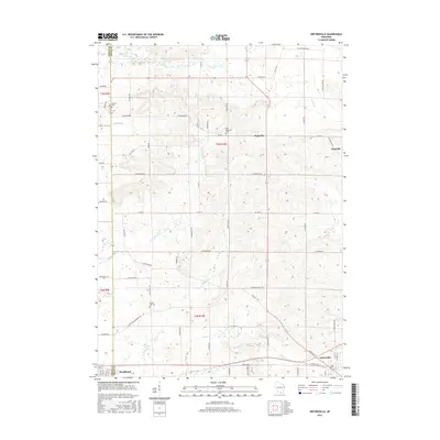
2016 Map of Orfordville
USGS Topo · Published 2016About this map
Orfordville and the eastern edge of Brodhead anchor this rural landscape along the Green Co and Rock Co border. The terrain is defined by a dense network of minor drainage systems including Allen Creek, Bass Creek, and Swan Creek, which snake through the agricultural grid. These waterways dictated early settlement patterns, leaving behind quiet hamlets like Magnolia and the crossroads at Cainville. Local family history is preserved in several rural burial grounds, such as Scotch Hill Cemetery and West Magnolia Cemetery, which sit among the undulating fields and secondary roads. The map reveals a highly structured township-and-range system, where roads like W Footville Brodhead Road and County Highway B connect disparate farmsteads and the smaller interior communities to the more established centers of commerce.
Find a feature on this map
65 named features on this map. Tap any name to fly to it.
Don’t see what you’re looking for? This feature index may not catch every label — zoom into the map to look around manually.
Map Details
Editions of this 2016 Orfordville Map
This is the sole edition of this map. No revisions or reprints were ever made.
Other maps of this area

1889 · Evansville
USGS Topo · 1:62,500

1890 · Stoughton
USGS Topo · 1:62,500

1891 · Janesville
USGS Topo · 1:62,500

1893 · Janesville
USGS Topo · 1:62,500

1893 · Brodhead
USGS Topo · 1:62,500

1894 · Evansville
USGS Topo · 1:62,500

1906 · Evansville
USGS Topo · 1:62,500

1954 · Rockford
USGS Topo · 1:250,000

1955 · Rockford
USGS Topo · 1:250,000

1958 · Rockford
USGS Topo · 1:250,000