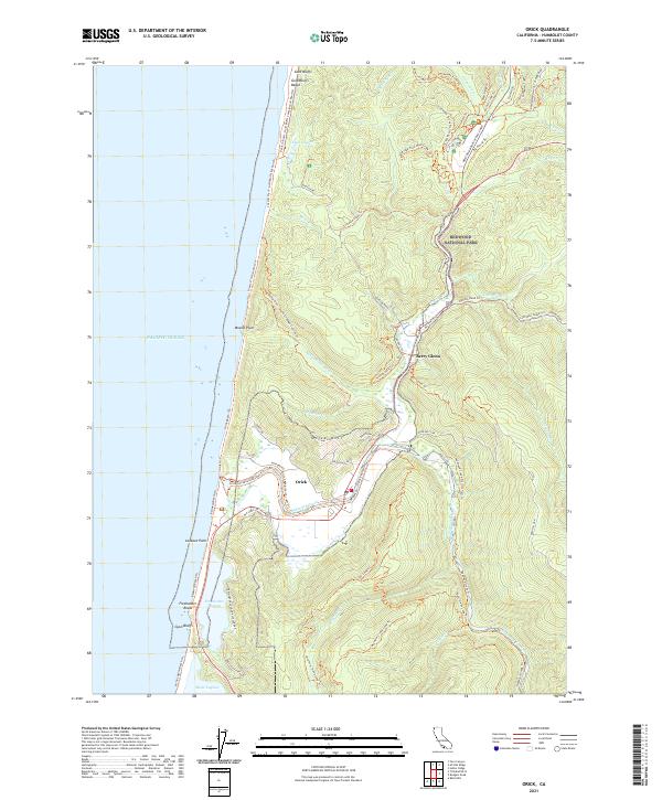
2021 Map of Orick
USGS Topo · Published 2021About this map
Orick serves as the focal point of this coastal landscape, situated where the Redwood Creek drainage meets the Pacific shoreline. The map documents a complex network of land and water, defined by the large coastal bodies of Freshwater Lagoon and Stone Lagoon to the south. Much of the interior is encompassed by Redwood National Park, showing the protected status of the old-growth environment through a dense system of trails like the Trillium Falls Trl and McArthur Creek Loop Trl. Evidence of earlier infrastructure remains visible through labels like Old State Hwy and the Orick Levee (North Side) Trl, which protects the low-lying settlement from the shifts of the creek. The transition from the high ridges of Orick Hill to the expanse of Gold Bluffs Beach illustrates the varied topography of the Humboldt County coast.
Find a feature on this map
74 named features on this map. Tap any name to fly to it.
Don’t see what you’re looking for? This feature index may not catch every label — zoom into the map to look around manually.
Map Details
Editions of this 2021 Orick Map
This is the sole edition of this map. No revisions or reprints were ever made.
Other maps of this area

1925 · Hoopa
USGS Topo · 1:125,000

1945 · Orick
USGS Topo · 1:62,500

1945 · Trinidad
USGS Topo · 1:62,500

1945 · Coyote Peak
USGS Topo · 1:62,500

1945 · Tectah Creek
USGS Topo · 1:62,500

1948 · Weed
USGS Topo · 1:250,000

1949 · Eureka
USGS Topo · 1:250,000

1950 · Weed
USGS Topo · 1:250,000
1952 · Orick
USGS Topo · 1:62,500

1952 · Coyote Peak
USGS Topo · 1:62,500