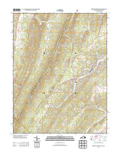
2013 Map of Orkney Springs
USGS Topo · Published 2013About this map
Orkney Springs and Basye anchor this section of the Great North Mountain region, showing a landscape defined by its historical springs and modern recreation. The resort character of the area is evident in the proximity of the Shrine Mont Church Camp to the more developed Bryce Resort and Bryce Airport. The presence of Lake Laura and Lake Carroll highlights the development of water resources for seasonal residents and visitors, while the surrounding terrain is marked by numerous springs such as Shenandoah Alum Springs and Upper Cove Spring.
Find a feature on this map
131 named features on this map. Tap any name to fly to it.
Don’t see what you’re looking for? This feature index may not catch every label — zoom into the map to look around manually.
Map Details
Editions of this 2013 Orkney Springs Map
This is the sole edition of this map. No revisions or reprints were ever made.
Other maps of this area

1892 · Woodstock
USGS Topo · 1:125,000

1921 · Orkney Springs
USGS Topo · 1:48,000

1923 · Orkney Springs
USGS Topo · 1:62,500

1923 · Edinburg
USGS Topo · 1:62,500

1940 · Orkney Springs
USGS Topo · 1:48,000

1942 · Mt Jackson
USGS Topo · 1:62,500

1943 · Orkney Springs
USGS Topo · 1:62,500

1944 · Orkney Springs
USGS Topo · 1:62,500

1946 · Mt Jackson
USGS Topo · 1:62,500

1947 · Mt Jackson
USGS Topo · 1:62,500