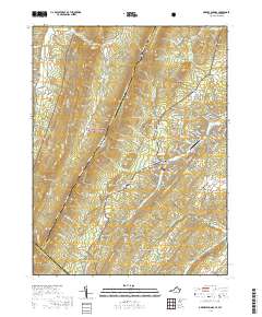
2019 Map of Orkney Springs
USGS Topo · Published 2019About this map
Orkney Springs serves as a central landmark in this portion of the Shenandoah Valley, situated beneath the heights of Great North Mountain. The landscape is defined by the sharp transition between the protected ridges of the George Washington National Forest and the developed resort areas around Basye. The map captures the specialized geography of the region, where leisure and aviation at Sky Bryce Airport sit adjacent to traditional settlements like Macanie and Hepners.
Find a feature on this map
141 named features on this map. Tap any name to fly to it.
Don’t see what you’re looking for? This feature index may not catch every label — zoom into the map to look around manually.
Map Details
Editions of this 2019 Orkney Springs Map
This is the sole edition of this map. No revisions or reprints were ever made.
Other maps of this area

1892 · Woodstock
USGS Topo · 1:125,000

1921 · Orkney Springs
USGS Topo · 1:48,000

1923 · Orkney Springs
USGS Topo · 1:62,500

1923 · Edinburg
USGS Topo · 1:62,500

1940 · Orkney Springs
USGS Topo · 1:48,000

1942 · Mt Jackson
USGS Topo · 1:62,500

1943 · Orkney Springs
USGS Topo · 1:62,500

1944 · Orkney Springs
USGS Topo · 1:62,500

1946 · Mt Jackson
USGS Topo · 1:62,500

1947 · Mt Jackson
USGS Topo · 1:62,500