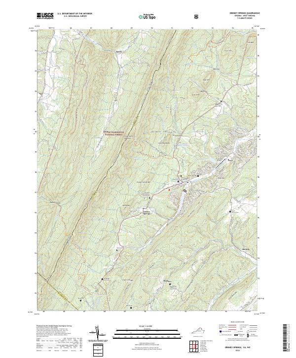
2022 Map of Orkney Springs
USGS Topo · Published 2022About this map
Orkney Springs serves as a central hub in this western Virginia mountain landscape, situated at the intersection of the Orkney Grade and Happy Valley Rd. The area is characterized by its numerous small cemeteries and rural churches, including the Prince of Peace Lutheran Church Cem and the Morning Star Lutheran Church Cem, which reflect the region's long-standing community roots. To the east, the development of Basye is marked by the Sky Bryce Airport and the waters of Lake Carroll, indicating a shift toward recreational geography alongside traditional settlements like Basore and Hepners. The terrain is defined by the high ridges of Cove Mountain and Timber Ridge, with the George Washington National Forest covering much of the western reaches. This landscape reveals a complex network of forest trails and mountain gaps, such as Hunkerson Gap, connecting the isolated valleys of the Shenandoah region.
Find a feature on this map
135 named features on this map. Tap any name to fly to it.
Don’t see what you’re looking for? This feature index may not catch every label — zoom into the map to look around manually.
Map Details
Editions of this 2022 Orkney Springs Map
This is the sole edition of this map. No revisions or reprints were ever made.
Other maps of this area

1892 · Woodstock
USGS Topo · 1:125,000

1921 · Orkney Springs
USGS Topo · 1:48,000

1923 · Orkney Springs
USGS Topo · 1:62,500

1923 · Edinburg
USGS Topo · 1:62,500

1940 · Orkney Springs
USGS Topo · 1:48,000

1942 · Mt Jackson
USGS Topo · 1:62,500

1943 · Orkney Springs
USGS Topo · 1:62,500

1944 · Orkney Springs
USGS Topo · 1:62,500

1946 · Mt Jackson
USGS Topo · 1:62,500

1947 · Mt Jackson
USGS Topo · 1:62,500