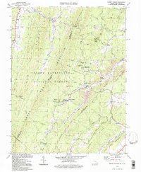
1994 Map of Orkney Springs
USGS Topo · Published 1997About this map
Orkney Springs serves as the focal point of this terrain where the George Washington National Forest meets the valley floor. The landscape is defined by the high ridges of Great North Mountain and Supin Lick Ridge, which channel drainage into watercourses like Stony Creek and Mill Creek. This area has long been a retreat and religious hub, evidenced by the presence of Shenandoah Alum Springs and the expansive Shrine Mont Church Camp near the center of the sheet.
Find a feature on this map
74 named features on this map. Tap any name to fly to it.
Don’t see what you’re looking for? This feature index may not catch every label — zoom into the map to look around manually.
Map Details
Editions of this 1994 Orkney Springs Map
This is the sole edition of this map. No revisions or reprints were ever made.
Other maps of this area

1892 · Woodstock
USGS Topo · 1:125,000

1921 · Orkney Springs
USGS Topo · 1:48,000

1923 · Orkney Springs
USGS Topo · 1:62,500

1923 · Edinburg
USGS Topo · 1:62,500

1940 · Orkney Springs
USGS Topo · 1:48,000

1942 · Mt Jackson
USGS Topo · 1:62,500

1943 · Orkney Springs
USGS Topo · 1:62,500

1944 · Orkney Springs
USGS Topo · 1:62,500

1946 · Mt Jackson
USGS Topo · 1:62,500

1947 · Mt Jackson
USGS Topo · 1:62,500