
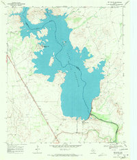
1968 Map of Orla NE
USGS Topo · Published 1971About this map
The Pecos River and the Tunstill watercourse define the southern reaches of this arid Permian Basin landscape, where industrial infrastructure and cattle ranching coexist. The presence of an expansive Oil Field and a network of pipelines crossing the state line reflects the region's late-1960s reliance on petroleum extraction. Amidst the industrial activity, the map documents the survival of ranching life through isolated landmarks like Boyd Ranch, which is supported by vital water sources such as Boyd Well and Double Well.
Find a feature on this map
15 named features on this map. Tap any name to fly to it.
Don’t see what you’re looking for? This feature index may not catch every label — zoom into the map to look around manually.
Map Details
Editions of this 1968 Orla NE Map
This is the sole edition of this map. No revisions or reprints were ever made.
Other maps of this area

1925 · Orla 2-b
USGS Topo · 1:48,000

1931 · Orla
USGS Topo · 1:62,500

1954 · Hobbs
USGS Topo · 1:250,000

1954 · Pecos
USGS Topo · 1:250,000

1957 · Pecos
USGS Topo · 1:250,000

1958 · Hobbs
USGS Topo · 1:250,000

1961 · Orla SE
USGS Topo · 1:24,000

1961 · Lindley Ranch
USGS Topo · 1:24,000

1968 · Orla
USGS Topo · 1:24,000
1968 · Red Bluff
USGS Topo · 1:24,000