
1961 Map of Lindley Ranch
USGS Topo · Published 1963About this map
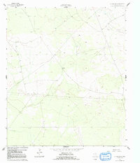
Lindley Ranch is the focal point of this 1961 survey, representing the sparse settlement patterns of Loving County in the early 1960s. The landscape is defined by the early infrastructure of the Permian Basin's energy economy, featuring several Oil Wells and a prominent Pipeline cutting across the terrain. Water management in this arid environment is evident through specifically placed landmarks like North Windmill and South Windmill. Numerous Drill Holes scattered across the map underscore the intensive exploration characteristic of this era. This survey, conducted by the USGS in cooperation with the State of Texas Water Commission, provides a clear record of the intersection between ranching and industrial expansion in one of the most sparsely populated regions of the state.
Find a feature on this map
9 named features on this map. Tap any name to fly to it.
Don’t see what you’re looking for? This feature index may not catch every label — zoom into the map to look around manually.
Map Details
Editions of this 1961 Lindley Ranch Map
2 editions found
Other maps of this area

1931 · Orla
USGS Topo · 1:62,500

1954 · Pecos
USGS Topo · 1:250,000

1957 · Pecos
USGS Topo · 1:250,000

1961 · Mentone
USGS Topo · 1:24,000

1961 · Anderson Ranch
USGS Topo · 1:24,000

1961 · Orla SE
USGS Topo · 1:24,000

1961 · Narrow Bow Draw
USGS Topo · 1:24,000

1968 · Orla NE
USGS Topo · 1:24,000

1969 · Kyle Ranch
USGS Topo · 1:24,000

1969 · Rudd Draw NE
USGS Topo · 1:24,000