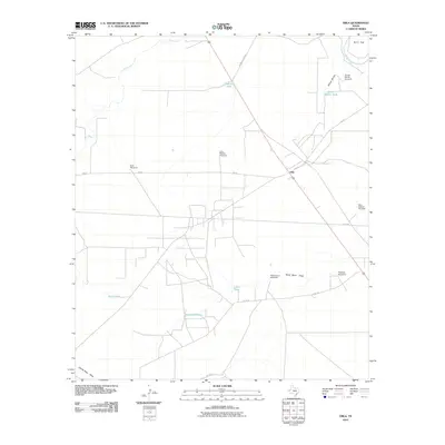
2010 Map of Orla
USGS Topo · Published 2010About this map
Orla serves as the central hub of this arid Reeves County landscape, situated at the intersection of FM 652 and the highway. The settlement pattern is defined by the critical need for water management in the Chihuahuan Desert, evidenced by a network of windmills and tanks scattered across the plains. Large-scale ranching operations are suggested by features like the Long Pasture Windmill and West Camp Windmill, which support livestock in an area where natural surface water is limited to seasonal drainages like Sand Bend Draw and Arroyo Bonito. To the northeast, the Pecos River cuts across the corner of the map near Burro Trap, providing a stark contrast to the surrounding ephemeral washes such as Salt Creek and Charlie Ross Draw. This survey illustrates the specialized infrastructure of West Texas, where named landmarks often center on life-sustaining water sources like Sand Bend Tank and Highway Tank.
Find a feature on this map
22 named features on this map. Tap any name to fly to it.
Don’t see what you’re looking for? This feature index may not catch every label — zoom into the map to look around manually.
Map Details
Editions of this 2010 Orla Map
This is the sole edition of this map. No revisions or reprints were ever made.
Other maps of this area

1925 · Orla 2-b
USGS Topo · 1:48,000

1931 · Orla
USGS Topo · 1:62,500

1954 · Van Horn
USGS Topo · 1:250,000

1954 · Pecos
USGS Topo · 1:250,000

1957 · Pecos
USGS Topo · 1:250,000

1958 · Van Horn
USGS Topo · 1:250,000

1961 · Orla SE
USGS Topo · 1:24,000

1961 · Narrow Bow Draw
USGS Topo · 1:24,000

1968 · Threemile Draw
USGS Topo · 1:24,000

1968 · Orla
USGS Topo · 1:24,000