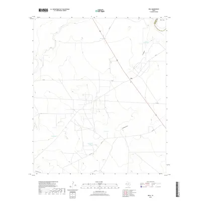
2019 Map of Orla
USGS Topo · Published 2019About this map
Orla sits as a lonely crossroads in the Chihuahuan Desert, situated near the intersection of FM 652 and US Highway 285. This arid landscape is defined by its drainage systems, including Salt Cr and the Pecos River which cuts across the northeastern corner. The presence of a Po in Orla marks it as a central point for the surrounding cattle country, where water management is critical to life. Numerous catchment features such as Highway Tank, Arroyo Bonito Tank, and Little Tank are scattered across the terrain, illustrating the necessity of water storage in this section of West Texas. The map also captures the Reeves Co Loving Co boundary and several named topographic depressions, including Arroyo Bonito, Sand Bend Draw, and Charlie Ross Draw, which dictate the local hydrology and travel routes through the scrubland.
Find a feature on this map
20 named features on this map. Tap any name to fly to it.
Don’t see what you’re looking for? This feature index may not catch every label — zoom into the map to look around manually.
Map Details
Editions of this 2019 Orla Map
This is the sole edition of this map. No revisions or reprints were ever made.
Other maps of this area

1925 · Orla 2-b
USGS Topo · 1:48,000

1931 · Orla
USGS Topo · 1:62,500

1954 · Van Horn
USGS Topo · 1:250,000

1954 · Pecos
USGS Topo · 1:250,000

1957 · Pecos
USGS Topo · 1:250,000

1958 · Van Horn
USGS Topo · 1:250,000

1961 · Orla SE
USGS Topo · 1:24,000

1961 · Narrow Bow Draw
USGS Topo · 1:24,000

1968 · Threemile Draw
USGS Topo · 1:24,000

1968 · Orla
USGS Topo · 1:24,000