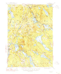
1948 Map of Orland
USGS Topo · Published 1948About this map
Alamoosook Lake and the interconnected waters of Branch Lake dominate this mid-century landscape on the border of Penobscot and Hancock counties. The area exhibits a rural economy transitioning toward recreation, evidenced by the established US Fish Hatchery near Loon Island and the resort community of Lucerne-in-Maine. Inland from the coast, the terrain is punctuated by significant elevations like Great Pond Mountain and Flying Moose Mountain, while the small settlement of East Holden Station serves as a reminder of earlier rail connections.
Find a feature on this map
144 named features on this map. Tap any name to fly to it.
Don’t see what you’re looking for? This feature index may not catch every label — zoom into the map to look around manually.
Map Details
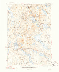
Editions of this 1948 Orland Map
2 editions found
Other maps of this area

1900 · Orland
USGS Topo · 1:62,500

1900 · Bucksport
USGS Topo · 1:62,500

1902 · Orono
USGS Topo · 1:62,500

1902 · Bucksport
USGS Topo · 1:62,500

1902 · Bangor
USGS Topo · 1:62,500

1902 · Castine
USGS Topo · 1:62,500

1904 · Castine
USGS Topo · 1:62,500

1904 · Mount Desert
USGS Topo · 1:62,500

1904 · Bluehill
USGS Topo · 1:62,500

1905 · Penobscot Bay
USGS Topo · 1:125,000