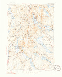
1948 Map of Orland
USGS Topo · Published 1948About this map
Phillips Lake and the Maine Central railroad tracks define the landscape of the northern Hancock County interior during the mid-1940s. The resort character of Lucerne-in-Maine contrasts with the surrounding network of crossroads communities like Winkumpaugh Corners, Harts Corners, and Five Mile Corners. This era reveals a transition from traditional land uses toward a more recreational economy, though industrial roots remain visible at the Annear Copper Mine near the southern boundary. To the west, Orland and East Orland are established hubs near the Penobscot County line, supported by a dense concentration of local landmarks such as East Bucksport Ch and several family burial grounds, including Oak Grove Cem and Evergreen Cem. The map provides a detailed view of the complex hydrology between Green Lake and Branch Lake, showing the many bogs and ponds that shaped local travel and settlement patterns.
Find a feature on this map
126 named features on this map. Tap any name to fly to it.
Don’t see what you’re looking for? This feature index may not catch every label — zoom into the map to look around manually.
Map Details
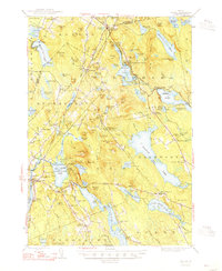
Editions of this 1948 Orland Map
2 editions found
Other maps of this area

1900 · Orland
USGS Topo · 1:62,500

1900 · Bucksport
USGS Topo · 1:62,500

1902 · Orono
USGS Topo · 1:62,500

1902 · Bucksport
USGS Topo · 1:62,500

1902 · Bangor
USGS Topo · 1:62,500

1902 · Castine
USGS Topo · 1:62,500

1904 · Castine
USGS Topo · 1:62,500

1904 · Mount Desert
USGS Topo · 1:62,500

1904 · Bluehill
USGS Topo · 1:62,500

1905 · Penobscot Bay
USGS Topo · 1:125,000