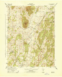
1944 Map of Orlean
USGS Topo · Published 1944About this map
Big Cobbler Mtn and Little Cobbler Mtn dominate the central landscape of this 1940s Fauquier County survey, shaping the drainage patterns and travel routes of the Piedmont region. The settlement of Orlean serves as a southern anchor, while smaller communities like Ada, Hume, and Ashville are dispersed along the road network. The map reveals a deeply rural character where life centered around local institutions such as Morgantown School and the Mt Nebo Church.
Find a feature on this map
20 named features on this map. Tap any name to fly to it.
Don’t see what you’re looking for? This feature index may not catch every label — zoom into the map to look around manually.
Map Details
Editions of this 1944 Orlean Map
This is the sole edition of this map. No revisions or reprints were ever made.
Other maps of this area

1893 · Luray
USGS Topo · 1:125,000

1894 · Warrenton
USGS Topo · 1:125,000

1894 · Warrenton
USGS Topo · 1:62,500

1905 · Luray
USGS Topo · 1:125,000

1927 · Remington
USGS Topo · 1:48,000

1930 · Warrenton
USGS Topo · 1:62,500

1939 · Front Royal
USGS Topo · 1:48,000

1943 · Orlean
USGS Topo · 1:24,000

1943 · Marshall
USGS Topo · 1:24,000

1943 · Upperville
USGS Topo · 1:24,000