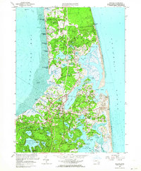
1962 Map of Orleans
USGS Topo · Published 1964About this map
Orleans and the surrounding outer Cape communities of Eastham and Brewster are defined by an intricate network of coastal ponds and Atlantic inlets in this 1962 revision. The landscape is characterized by the long barrier of Nauset Beach and the protected waters of Town Cove and Nauset Harbor. The transportation infrastructure shows U.S. Route 6 bisecting the peninsula alongside the tracks of the New Haven RR, while local landmarks like the Nauset Beach Lighthouse and Eldredge Park anchor the seaside settlements. The map documents the region's agricultural and maritime character through numerous Cranberry Bogs and landings such as Campground Landing and Rock Harbor. Inland, the expansive Nickerson State Park preserves a cluster of kettle ponds, including Cliff Pond and Flax Pond, illustrating the glacial topography of the lower Cape before the intense development of later decades.
Find a feature on this map
91 named features on this map. Tap any name to fly to it.
Don’t see what you’re looking for? This feature index may not catch every label — zoom into the map to look around manually.
Map Details
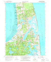
Editions of this 1962 Orleans Map
2 editions found
Other maps of this area

1887 · Wellfleet
USGS Topo · 1:62,500

1887 · Yarmouth
USGS Topo · 1:62,500

1888 · Chatham
USGS Topo · 1:62,500

1889 · Yarmouth
USGS Topo · 1:62,500

1889 · Wellfleet
USGS Topo · 1:62,500

1893 · Chatham
USGS Topo · 1:62,500

1893 · Yarmouth
USGS Topo · 1:62,500

1893 · Wellfleet
USGS Topo · 1:62,500

1917 · Chatham
USGS Topo · 1:62,500

1942 · Cape Cod Bay
USGS Topo · 1:125,000