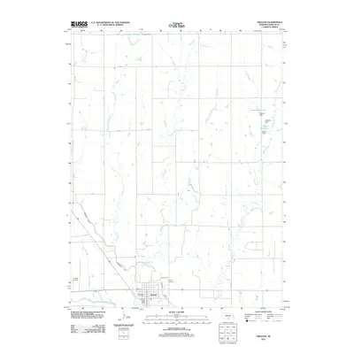
2011 Map of Orleans
USGS Topo · Published 2011About this map
Orleans anchors the southern portion of this Harlan County landscape, situated just north of the Republican River. The settlement pattern here is defined by its relationship to water management and agriculture, most notably through the Cambridge Canal which snakes across the western terrain toward the town. This infrastructure is complemented by several small, privately named impoundments such as Einspahr Reservoir, Flasnick Reservoir, and Massey Reservoir, each controlled by its own namesake dam. These features illustrate the local necessity of water storage in this section of the Great Plains. Cultural and civic landmarks are clustered within the town grid, including the Orleans Post Office and the Orleans RV Park, while the Calvary Cemetery sits on the eastern edge. To the west, the L J Bose Airstrip provides a localized aviation point among the drainages of Milrose Creek and Flag Creek.
Find a feature on this map
24 named features on this map. Tap any name to fly to it.
Don’t see what you’re looking for? This feature index may not catch every label — zoom into the map to look around manually.
Map Details
Editions of this 2011 Orleans Map
This is the sole edition of this map. No revisions or reprints were ever made.
Other maps of this area

1896 · Holdrege
USGS Topo · 1:125,000

1896 · Arapahoe
USGS Topo · 1:125,000

1898 · Arapahoe
USGS Topo · 1:125,000

1955 · Grand Island
USGS Topo · 1:250,000

1957 · Grand Island
USGS Topo · 1:250,000

1957 · Stamford SE
USGS Topo · 1:24,000

1958 · Grand Island
USGS Topo · 1:250,000

1958 · Stamford
USGS Topo · 1:24,000

1958 · Mascot
USGS Topo · 1:24,000

1970 · Ragan
USGS Topo · 1:24,000