
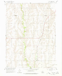
1958 Map of Mascot
USGS Topo · Published 1960About this map
The agrarian landscape of the Phelps Co Harlan Co border region is defined by the winding course of Spring Creek, which carves a distinct green valley through the loess hills of south-central Nebraska. This 1958 field-checked survey reveals the tight-knit network of civil townships, including Spring Grove, Albany, and Emerson, where section lines dictate the grid of rural roads and homesteads.
Find a feature on this map
16 named features on this map. Tap any name to fly to it.
Don’t see what you’re looking for? This feature index may not catch every label — zoom into the map to look around manually.
Map Details
Editions of this 1958 Mascot Map
2 editions found
Other maps of this area

1896 · Holdrege
USGS Topo · 1:125,000

1896 · Arapahoe
USGS Topo · 1:125,000

1898 · Arapahoe
USGS Topo · 1:125,000

1955 · Grand Island
USGS Topo · 1:250,000

1957 · Grand Island
USGS Topo · 1:250,000

1958 · Grand Island
USGS Topo · 1:250,000

1958 · Hollinger
USGS Topo · 1:24,000

1958 · Stamford
USGS Topo · 1:24,000
1958 · Oxford
USGS Topo · 1:24,000
1970 · Loomis
USGS Topo · 1:24,000