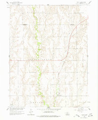
1958 Map of Mascot
USGS Topo · Published 1977About this map
Spring Creek meanders southward through the heart of the central Nebraska plains, defining a landscape of deeply etched drainages and agricultural section lines. In the late 1950s, the small settlement of Mascot served as a local hub along the Chicago Burlington and Quincy railroad, which cuts a diagonal path across the rolling terrain. The map reveals a high concentration of named townships and precincts, including Spring Grove, Albany, and Industry, reflecting the organized rural structure of the era. Genealogists can locate several historic burial grounds, such as Spring Grove Cem and Oxford Cem near the town of Oxford. The network of tributary waters like Deep Creek and Elm Creek illustrates the intricate natural irrigation system that supported the region's farming townships during the mid-20th century.
Find a feature on this map
16 named features on this map. Tap any name to fly to it.
Don’t see what you’re looking for? This feature index may not catch every label — zoom into the map to look around manually.
Map Details
Editions of this 1958 Mascot Map
2 editions found
Other maps of this area

1896 · Holdrege
USGS Topo · 1:125,000

1896 · Arapahoe
USGS Topo · 1:125,000

1898 · Arapahoe
USGS Topo · 1:125,000

1955 · Grand Island
USGS Topo · 1:250,000

1957 · Grand Island
USGS Topo · 1:250,000

1958 · Grand Island
USGS Topo · 1:250,000

1958 · Hollinger
USGS Topo · 1:24,000

1958 · Stamford
USGS Topo · 1:24,000

1958 · Mascot
USGS Topo · 1:24,000
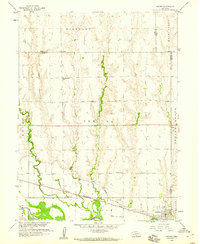
1958 · Oxford
USGS Topo · 1:24,000