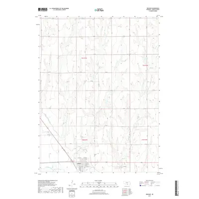
2017 Map of Orleans
USGS Topo · Published 2017About this map
Orleans stands at the confluence of several vital water systems in Harlan County, situated along the northern banks of the Republican River. The town's grid is clearly defined by local streets such as E Linn St, E Maple St, and W Cedar St, reflecting a community centered around the river valley and regional transportation. To the north, the landscape is defined by the drainage basins of Milrose Cr, School Cr, and Flag Cr, which cut through the high plains toward the river. The agricultural infrastructure of the era is evident in the presence of the Cambridge Canal and several upland water storage features like Massey Reservoir and Einspahr Reservoir. Local heritage is anchored by the Calvary Cem, positioned just outside the main residential blocks.
Find a feature on this map
33 named features on this map. Tap any name to fly to it.
Don’t see what you’re looking for? This feature index may not catch every label — zoom into the map to look around manually.
Map Details
Editions of this 2017 Orleans Map
This is the sole edition of this map. No revisions or reprints were ever made.
Other maps of this area

1896 · Holdrege
USGS Topo · 1:125,000

1896 · Arapahoe
USGS Topo · 1:125,000

1898 · Arapahoe
USGS Topo · 1:125,000

1955 · Grand Island
USGS Topo · 1:250,000

1957 · Grand Island
USGS Topo · 1:250,000

1957 · Stamford SE
USGS Topo · 1:24,000

1958 · Grand Island
USGS Topo · 1:250,000

1958 · Stamford
USGS Topo · 1:24,000

1958 · Mascot
USGS Topo · 1:24,000

1970 · Ragan
USGS Topo · 1:24,000