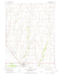
1973 Map of Orleans
USGS Topo · Published 1977About this map
Republican River bottomlands and the northern reaches of Harlan County Lake anchor this 1970s survey of southern Nebraska. The town of Orleans sits at the intersection of the Burlington Northern railroad and several vital water management systems, including the Cambridge Siphon and an extensive Canal. The landscape is defined by the drainage patterns of numerous north-south waterways such as School Creek, Milrose Creek, Flag Creek, and Rope Creek, which cut through the agricultural terrain toward the river valley.
Find a feature on this map
18 named features on this map. Tap any name to fly to it.
Don’t see what you’re looking for? This feature index may not catch every label — zoom into the map to look around manually.
Map Details
Editions of this 1973 Orleans Map
This is the sole edition of this map. No revisions or reprints were ever made.
Other maps of this area

1896 · Holdrege
USGS Topo · 1:125,000

1896 · Arapahoe
USGS Topo · 1:125,000

1898 · Arapahoe
USGS Topo · 1:125,000

1955 · Grand Island
USGS Topo · 1:250,000

1957 · Grand Island
USGS Topo · 1:250,000

1957 · Stamford SE
USGS Topo · 1:24,000

1958 · Grand Island
USGS Topo · 1:250,000

1958 · Stamford
USGS Topo · 1:24,000

1958 · Mascot
USGS Topo · 1:24,000

1970 · Ragan
USGS Topo · 1:24,000