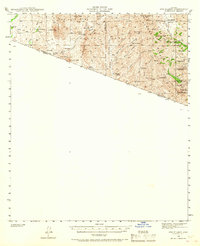
1942 Map of Oro Blanco
USGS Topo · Published 1968About this map
Hard-rock mining operations dominate the high desert terrain of the Coronado National Forest along the international border in the early 1940s. The settlement of Oro Blanco serves as a central point for a landscape marked by numerous inactive extraction sites, including the Yellow Jacket Mine, Old Glory Mine, and Austerlitz Mine. These features illustrate the fading pulse of a once-booming mining district.
Find a feature on this map
43 named features on this map. Tap any name to fly to it.
Don’t see what you’re looking for? This feature index may not catch every label — zoom into the map to look around manually.
Map Details
Editions of this 1942 Oro Blanco Map
3 editions found
Other maps of this area

1920 · Arivaca
USGS Topo · 1:125,000

1921 · Old Glory
USGS Topo · 1:125,000

1939 · Tubac
USGS Topo · 1:62,500

1941 · Presumido Peak
USGS Topo · 1:62,500

1941 · Arivaca
USGS Topo · 1:62,500

1942 · Ruby
USGS Topo · 1:62,500

1942 · Oro Blanco
USGS Topo · 1:62,500

1943 · Fresnal
USGS Topo · 1:125,000

1943 · Arivaca
USGS Topo · 1:62,500

1943 · Old Glory
USGS Topo · 1:125,000