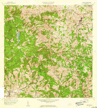
1957 Map of Orocovis
USGS Topo · Published 1960About this map
Orocovis serves as a primary hub in this central Puerto Rican landscape, where the town's namesake Rio Orocovis winds through a complex network of high peaks and deep stream valleys. The high-altitude terrain is anchored by summits such as Cerro Doña Juana and Cerro Mime, with the waters of Lago de Matrullas collected to the west. This 1957 revision reveals a rural economy organized around named land tracts and estates like Hacienda Limón, connected by winding roads such as Insular Route 151. The distribution of small settlements like Céspedes and Villalba, alongside community institutions like the Escuela Segunda Unidad de Bauta and Capilla de San José, illustrates the post-war social geography of the Cordillera Central. Numerous named streams, including Quebrada Sana Muerto and Quebrada El Gato, define the intricate drainage patterns that shaped local development and agriculture during this era.
Find a feature on this map
59 named features on this map. Tap any name to fly to it.
Don’t see what you’re looking for? This feature index may not catch every label — zoom into the map to look around manually.
Map Details
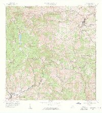
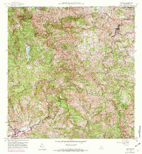
Editions of this 1957 Orocovis Map
3 editions found
Other maps of this area

1945 · Ponce
USGS Topo · 1:30,000

1945 · Rio Descalabrado
USGS Topo · 1:30,000

1946 · Coamo
USGS Topo · 1:30,000

1946 · Corozal
USGS Topo · 1:30,000

1946 · Barranquitas
USGS Topo · 1:30,000

1946 · Ciales
USGS Topo · 1:30,000

1946 · Jayuya
USGS Topo · 1:30,000

1946 · Florida
USGS Topo · 1:30,000

1946 · Orocovis
USGS Topo · 1:30,000

1947 · Corozal SO
USGS Topo · 1:10,000