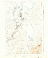
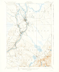
1902 Map of Orono
USGS Topo · Published 1942About this map
Old Town and Orono serve as the industrial and academic anchors of this early 20th-century landscape along the Penobscot River. The map reveals a complex riverine environment where the Stillwater River branches off to form the significant landmass of Marsh Island, home to the University. This era was defined by water-powered industry and heavy rail transport, evidenced by the clusters of activity at Great Works, Basin Mills, and Milford.
Find a feature on this map
63 named features on this map. Tap any name to fly to it.
Don’t see what you’re looking for? This feature index may not catch every label — zoom into the map to look around manually.
Map Details
Editions of this 1902 Orono Map
6 editions found
Other maps of this area

1900 · Orland
USGS Topo · 1:62,500

1900 · Bucksport
USGS Topo · 1:62,500

1902 · Orono
USGS Topo · 1:62,500

1902 · Bucksport
USGS Topo · 1:62,500

1902 · Bangor
USGS Topo · 1:62,500

1911 · Ellsworth
USGS Topo · 1:62,500

1917 · Passadumkeag
USGS Topo · 1:62,500

1929 · Great Pond
USGS Topo · 1:48,000

1931 · Saponac
USGS Topo · 1:48,000

1932 · Great Pond
USGS Topo · 1:62,500