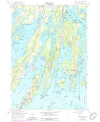
1957 Map of Orrs Island
USGS Topo · Published 1989About this map
Harpswell Neck and its surrounding archipelago dominate this mid-century survey, revealing a landscape defined by deep-water coves and historical maritime settlements. The map highlights the coastal geography of Orrs Island and Harpswell Center, where the transition from traditional fishing villages to more modern uses is visible, particularly with the establishment of the U S Naval Air Station to the north. Social and spiritual centers of the era are carefully noted, including the Queen of the Mission Chapel, the Union Ch on Orrs Island, and the Harpswell Islands Sch.
Find a feature on this map
133 named features on this map. Tap any name to fly to it.
Don’t see what you’re looking for? This feature index may not catch every label — zoom into the map to look around manually.
Map Details
Editions of this 1957 Orrs Island Map
4 editions found
Other maps of this area

1892 · Freeport
USGS Topo · 1:62,500

1893 · Small Point
USGS Topo · 1:62,500

1893 · Casco Bay
USGS Topo · 1:62,500

1894 · Bath
USGS Topo · 1:62,500

1914 · Casco Bay
USGS Topo · 1:48,000

1916 · Casco Bay
USGS Topo · 1:62,500

1916 · Portland And Vicinity
USGS Topo · 1:62,500

1918 · Portland And Vicinity
USGS Topo · 1:62,500

1919 · Small Point
USGS Topo · 1:62,500

1920 · Bath
USGS Topo · 1:62,500