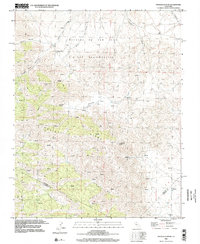
2000 Map of Ortigalita Peak
USGS Topo · Published 2002About this map
Ortigalita Ridge dominates this California landscape, defining the rugged boundary where Merced, San Benito, and Fresno Counties converge. At its highest point, Ortigalita Peak overlooks a complex system of drainage and seasonal water sources, including Piedra Azul Creek and Ortigalita Creek. This survey reflects the arid character of the Inner Coast Ranges at the start of the 21st century, where human activity is primarily represented by dispersed prospects and cattle-related water improvements like Carranza Spring and Piedra Azul Spring. To the east, the land descends into the Little Pan Oche Valley, while the western reaches are carved by Molina Canyon and Piedra Azul Canyon. The map preserves the large-scale Spanish land grant boundaries of Panoche De San Juan and Y Los Carrisalitos, illustrating how historical property lines continue to shape the geography of the California interior.
Find a feature on this map
20 named features on this map. Tap any name to fly to it.
Don’t see what you’re looking for? This feature index may not catch every label — zoom into the map to look around manually.
Map Details
Editions of this 2000 Ortigalita Peak Map
This is the sole edition of this map. No revisions or reprints were ever made.
Other maps of this area

1913 · Panoche
USGS Topo · 1:125,000

1919 · San Benito
USGS Topo · 1:62,500

1920 · Carrisalito Spring
USGS Topo · 1:31,680

1921 · Laguna Seca Ranch
USGS Topo · 1:31,680

1922 · Charleston School
USGS Topo · 1:31,680

1922 · Quien Sabe
USGS Topo · 1:62,500

1922 · Ortigalita
USGS Topo · 1:31,680

1923 · Laguna Seca Ranch
USGS Topo · 1:31,680

1931 · San Benito
USGS Topo · 1:62,500

1940 · Quien Sabe
USGS Topo · 1:62,500