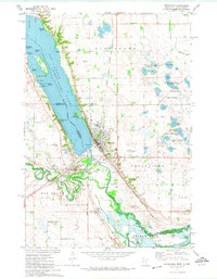
1971 Map of Ortonville
USGS Topo · Published 1974About this map
Big Stone Lake serves as the focal point for this 1971 study of the Minnesota-South Dakota border, where the waters define the boundary between Big Stone and Grant counties. The shoreline is dotted with small communities and recreation sites, including Lagoona Beach, Manhattan Island, and the developed area of Ortonville. This port-like atmosphere is reinforced by Chautauqua Park and the Fish Hatchery near Kite Island.
Find a feature on this map
48 named features on this map. Tap any name to fly to it.
Don’t see what you’re looking for? This feature index may not catch every label — zoom into the map to look around manually.
Map Details
Editions of this 1971 Ortonville Map
This is the sole edition of this map. No revisions or reprints were ever made.
Other maps of this area

1953 · Ortonville
USGS Topo · 1:62,500

1953 · Bellingham
USGS Topo · 1:62,500

1953 · Milbank
USGS Topo · 1:250,000

1954 · Big Stone Lake
USGS Topo · 1:62,500

1958 · Milbank
USGS Topo · 1:250,000

1971 · Big Stone Lake East
USGS Topo · 1:24,000

1971 · Dismal Swamp
USGS Topo · 1:24,000

1971 · Odessa
USGS Topo · 1:24,000
1971 · Bellingham
USGS Topo · 1:24,000

1971 · Rosen
USGS Topo · 1:24,000