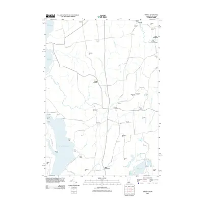
2011 Map of Orwell
USGS Topo · Published 2011About this map
The rolling Champlain Valley landscape around Orwell and Richville is defined by its deep agricultural roots and its connection to the water. This 2011 survey illustrates a region where local history is etched into the terrain through numerous family and community burial grounds, including the Rich Family Cemetery, Jennison Cemetery, and Saint Pauls Cemetery. Along the eastern edge, the East Shoreham Covered Railroad Bridge stands as a notable surviving structure of the area's transportation heritage. To the west, the shoreline of Lake Champlain features landmarks such as the Orwell Bluff Light and Orwell Landing, where the land meets the water at Gourlie Point. Inland, the drainage of East Creek is managed by several modern impoundments like the East Creek Site 1 Dam, reflecting the ongoing human management of the local watershed between heights like Needham Hill and The Pinnacle.
Find a feature on this map
101 named features on this map. Tap any name to fly to it.
Don’t see what you’re looking for? This feature index may not catch every label — zoom into the map to look around manually.
Map Details
Editions of this 2011 Orwell Map
This is the sole edition of this map. No revisions or reprints were ever made.
Other maps of this area

1893 · Whitehall
USGS Topo · 1:62,500

1894 · Ticonderoga
USGS Topo · 1:62,500

1895 · Whitehall
USGS Topo · 1:62,500

1895 · Castleton
USGS Topo · 1:62,500

1896 · Ticonderoga
USGS Topo · 1:62,500

1897 · Castleton
USGS Topo · 1:62,500

1898 · Whitehall
USGS Topo · 1:62,500

1902 · Whitehall
USGS Topo · 1:62,500

1902 · Ticonderoga
USGS Topo · 1:62,500

1902 · Brandon
USGS Topo · 1:62,500