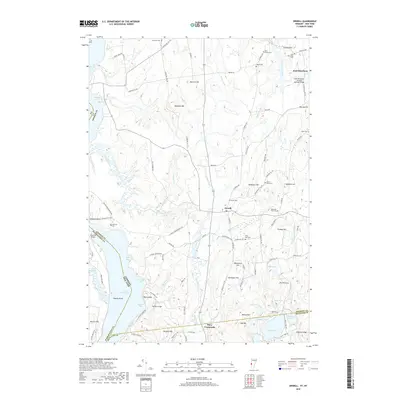
2018 Map of Orwell
USGS Topo · Published 2018About this map
Lake Champlain serves as the western boundary of this Vermont-New York borderlands map, where the rural character of Addison and Rutland Counties is defined by its complex hydrography and burial grounds. The settlement of Orwell sits centrally, surrounded by an extensive network of family and community cemeteries such as the Rich Family Cem, Jennison Cem, and Lepell Cem, which provide significant data for genealogical research. The landscape transitions from the marshy edges of Negro Marsh and Hands Cove to a series of prominent elevations like Hardigan Hill and The Pinnacle. A notable piece of transportation infrastructure is preserved at the northeastern corner, where the East Shoreham Covered Railroad Bridge spans the Lemon Fair River, marking a intersection of rail history and traditional New England architecture. The map also traces the winding courses of East Creek and its many forks, which drain the lowlands into the bays of the lake.
Find a feature on this map
119 named features on this map. Tap any name to fly to it.
Don’t see what you’re looking for? This feature index may not catch every label — zoom into the map to look around manually.
Map Details
Editions of this 2018 Orwell Map
This is the sole edition of this map. No revisions or reprints were ever made.
Other maps of this area

1893 · Whitehall
USGS Topo · 1:62,500

1894 · Ticonderoga
USGS Topo · 1:62,500

1895 · Whitehall
USGS Topo · 1:62,500

1895 · Castleton
USGS Topo · 1:62,500

1896 · Ticonderoga
USGS Topo · 1:62,500

1897 · Castleton
USGS Topo · 1:62,500

1898 · Whitehall
USGS Topo · 1:62,500

1902 · Whitehall
USGS Topo · 1:62,500

1902 · Ticonderoga
USGS Topo · 1:62,500

1902 · Brandon
USGS Topo · 1:62,500