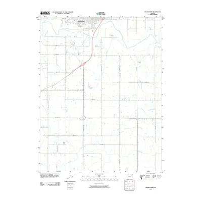
2009 Map of Osawatomie
USGS Topo · Published 2009About this map
Osawatomie sits at the northern edge of this landscape where the Pottawatomie Creek meets the Marais des Cygnes River. The town's grid is bounded by Main St and South St, showing a developed core that contrasts with the surrounding agricultural land. To the south, the smaller settlement of Beagle occupies a crossroads along Plum Creek Rd, while the name Bangor appears to the east of the main river valley. The terrain is defined by a dense network of watercourses including Hushpuckney Creek, Middle Creek, and Mound Creek, which drain into the larger river system. Local history and genealogy are anchored by rural landmarks such as Whiteford Cemetery in the northeast and Mound Creek Cemetery in the southwest, reflecting the long-established burial sites of Miami County families.
Find a feature on this map
35 named features on this map. Tap any name to fly to it.
Don’t see what you’re looking for? This feature index may not catch every label — zoom into the map to look around manually.
Map Details
Editions of this 2009 Osawatomie Map
This is the sole edition of this map. No revisions or reprints were ever made.
Other maps of this area

1885 · Garnett
USGS Topo · 1:125,000

1885 · Lawrence
USGS Topo · 1:125,000

1887 · Olathe
USGS Topo · 1:125,000

1887 · Mound City
USGS Topo · 1:125,000

1889 · Lawrence
USGS Topo · 1:125,000

1893 · Mound City
USGS Topo · 1:125,000

1893 · Olathe
USGS Topo · 1:125,000

1894 · Garnett
USGS Topo · 1:125,000

1947 · Lawrence
USGS Topo · 1:250,000

1950 · Lawrence
USGS Topo · 1:250,000