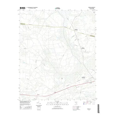
2017 Map of Osborn
USGS Topo · Published 2017About this map
Caw Caw Swamp and Drayton Swamp dominate the low-lying terrain of this Lowcountry landscape, where the boundary between Dorchester Co and Charleston Co is defined by drainage patterns and historic thoroughfares. The settlement pattern is characterized by distinct rural nodes such as Delemar Crossroads, Warren Crossroads, and Capwells Crossroads, which serve as junctions for local travel. Higher ground is marked by features like Raven Hill and Coon Island, providing contrast to the surrounding Horse Savanna. Transport routes like the historic Parkers Ferry Rd and Old Jacksonboro Rd parallel the southern rail corridor through Ravenel, Jericho, and Osborn. Evidence of local history and land use is preserved in names like Lacy Plantation and the White Cem near the junction of State Hwy 165.
Find a feature on this map
43 named features on this map. Tap any name to fly to it.
Don’t see what you’re looking for? This feature index may not catch every label — zoom into the map to look around manually.
Map Details
Editions of this 2017 Osborn Map
This is the sole edition of this map. No revisions or reprints were ever made.
Other maps of this area

1918 · Cottageville
USGS Topo · 1:62,500

1919 · Edisto Island
USGS Topo · 1:62,500

1919 · Wadmelaw Island
USGS Topo · 1:62,500

1920 · Ravenels
USGS Topo · 1:62,500

1943 · Cottageville
USGS Topo · 1:62,500

1943 · Edisto Island
USGS Topo · 1:62,500

1944 · Ravenels
USGS Topo · 1:62,500

1944 · Wadmelaw Island
USGS Topo · 1:62,500

1947 · Savannah
USGS Topo · 1:250,000

1948 · Savannah
USGS Topo · 1:250,000