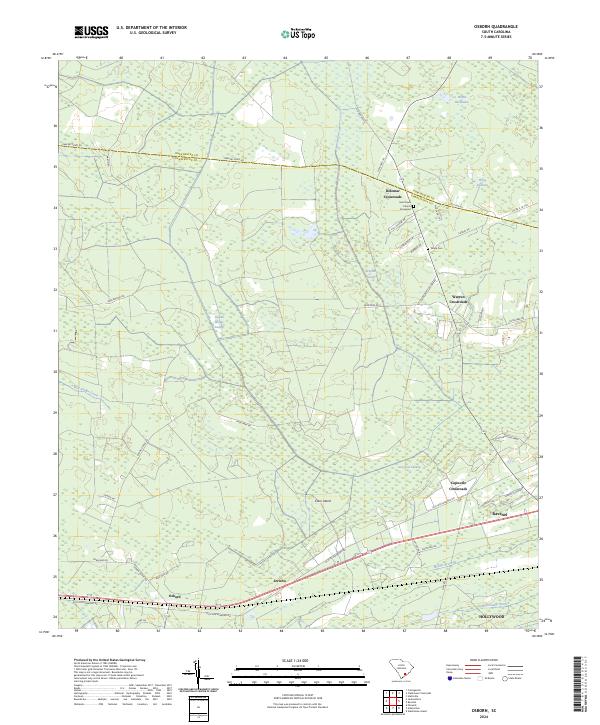
2024 Map of Osborn
USGS Topo · Published 2024About this map
Saint Pauls Church & Graveyard stands as a central historical landmark in this Lowcountry landscape where the boundary between Dorchester Co and Charleston Co is defined by rural road networks and expansive wetlands. The settlement pattern is characterized by several distinct intersections, including Delemar Crossroads, Warren Crossroads, and Capwells Crossroads, which historically served as local hubs for the surrounding agricultural and timber lands.
Find a feature on this map
47 named features on this map. Tap any name to fly to it.
Don’t see what you’re looking for? This feature index may not catch every label — zoom into the map to look around manually.
Map Details
Editions of this 2024 Osborn Map
This is the sole edition of this map. No revisions or reprints were ever made.
Other maps of this area

1918 · Cottageville
USGS Topo · 1:62,500

1919 · Edisto Island
USGS Topo · 1:62,500

1919 · Wadmelaw Island
USGS Topo · 1:62,500

1920 · Ravenels
USGS Topo · 1:62,500

1943 · Cottageville
USGS Topo · 1:62,500

1943 · Edisto Island
USGS Topo · 1:62,500

1944 · Ravenels
USGS Topo · 1:62,500

1944 · Wadmelaw Island
USGS Topo · 1:62,500

1947 · Savannah
USGS Topo · 1:250,000

1948 · Savannah
USGS Topo · 1:250,000