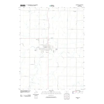
2009 Map of Osborne
USGS Topo · Published 2009About this map
Osborne serves as the focal point of this Kansas prairie landscape, situated where the South Fork Solomon River winds through the central terrain. The settlement’s grid is neatly bisected by Connecticut St and N Ash St, reflecting a well-established agricultural hub. Local history and genealogy are anchored by several burial grounds on the town's periphery, including Bethany Center Cemetery, Osborne Cemetery, and Saint Aloysius Cemetery. Water management is evident along the riverbanks, most notably at the Osborne Diversion Dam, while the Osborne Municipal Airport marks the eastern edge of the community. Beyond the town limits, the landscape transitions to a vast network of section roads like S 130th Ave and W 50th Dr, punctuated by the drainage systems of Covert Creek and Indian Creek.
Find a feature on this map
33 named features on this map. Tap any name to fly to it.
Don’t see what you’re looking for? This feature index may not catch every label — zoom into the map to look around manually.
Map Details
Editions of this 2009 Osborne Map
This is the sole edition of this map. No revisions or reprints were ever made.
Other maps of this area

1893 · Smith Center
USGS Topo · 1:125,000

1896 · Osborne
USGS Topo · 1:125,000

1953 · Downs South
USGS Topo · 1:24,000

1953 · Bloomington
USGS Topo · 1:24,000

1953 · Osborne
USGS Topo · 1:24,000

1955 · Beloit
USGS Topo · 1:250,000

1959 · Beloit
USGS Topo · 1:250,000

1960 · Downs North
USGS Topo · 1:24,000

1961 · Portis
USGS Topo · 1:24,000

1961 · Harlan
USGS Topo · 1:24,000