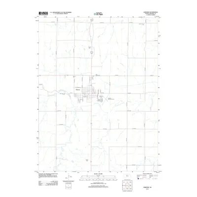
2012 Map of Osborne
USGS Topo · Published 2012About this map
The S Fork Solomon River winds through the heart of this landscape, anchoring the city of Osborne. This 2012 survey illustrates a classic Kansas county seat, where the grid of city streets meets the expansive agricultural section lines of the surrounding plains. To the north and south, North Hill and South Hill provide modest topographic relief above the river valley. The map is a significant resource for those tracing local heritage, as it identifies several key burial sites including Osborne Cem, Bethany Center Cem, and Saint Aloysius Cem. Community life is centered around the Osborne County Fairgrounds and the Osborne Speedway, while the Osborne Municipal Airport and Shady Bend Golf Course mark the modern fringes of the town. Smaller tributaries like Covert Cr and Indian Cr feed into the river system, defining the drainage patterns across this north-central Kansas territory.
Find a feature on this map
52 named features on this map. Tap any name to fly to it.
Don’t see what you’re looking for? This feature index may not catch every label — zoom into the map to look around manually.
Map Details
Editions of this 2012 Osborne Map
This is the sole edition of this map. No revisions or reprints were ever made.
Other maps of this area

1893 · Smith Center
USGS Topo · 1:125,000

1896 · Osborne
USGS Topo · 1:125,000

1953 · Downs South
USGS Topo · 1:24,000

1953 · Bloomington
USGS Topo · 1:24,000

1953 · Osborne
USGS Topo · 1:24,000

1955 · Beloit
USGS Topo · 1:250,000

1959 · Beloit
USGS Topo · 1:250,000

1960 · Downs North
USGS Topo · 1:24,000

1961 · Portis
USGS Topo · 1:24,000

1961 · Harlan
USGS Topo · 1:24,000