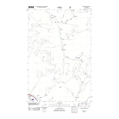
2011 Map of Osburn
USGS Topo · Published 2011About this map
The South Fork Coeur d'Alene River valley and the surrounding Bitterroot Mountains define this landscape, where early 21st-century mining operations and legacy settlements dot the terrain. Osburn sits at the southwestern edge, while the industrial imprint of the Silver Valley is evident through features like the Day Mine Tailings Dam near Ninemile Creek. The map documents a complex drainage system flowing through narrow gulches, many bearing names tied to the area's mineral-rich history such as Placer Gulch, California Gulch, and Missouri Gulch. Small clusters like Blackcloud and Bunn are situated along these steep drainages, connected by a network of forest and county roads including Beaver Creek Rd and Nine Mile Rd. From the high elevations of Dago Peak to the creek bottoms at Delta, the map captures the geographic intersection of Shoshone County's mining heritage and its modern land management.
Find a feature on this map
67 named features on this map. Tap any name to fly to it.
Don’t see what you’re looking for? This feature index may not catch every label — zoom into the map to look around manually.
Map Details
Editions of this 2011 Osburn Map
This is the sole edition of this map. No revisions or reprints were ever made.
Other maps of this area

1901 · Coeur D'Alene District
USGS Topo · 1:62,500

1903 · Coeur D'Alene District
USGS Topo · 1:62,500

1906 · Coeur D'Alene District
USGS Topo · 1:62,500

1909 · Cataldo
USGS Topo · 1:125,000

1911 · Cataldo
USGS Topo · 1:125,000

1914 · Avery
USGS Topo · 1:125,000

1917 · Avery
USGS Topo · 1:125,000

1932 · Trout Creek
USGS Topo · 1:125,000

1935 · Trout Creek
USGS Topo · 1:125,000

1936 · Trout Creek
USGS Topo · 1:125,000