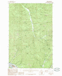
1985 Map of Osburn
USGS Topo · Published 1985About this map
Osburn serves as a primary point of settlement along the South Fork Coeur d'Alene River at the base of a complex drainage network. The landscape is defined by the steep topography of the Coeur d'Alene National Forest, where numerous drainages like Placer Gulch, Potosi Gulch, and California Gulch feed into the larger north-south corridor of Beaver Creek. The naming conventions throughout the area, including Capital Hill and Nuckols Mountain, reflect the region's historical connection to resource extraction and surveying.
Find a feature on this map
54 named features on this map. Tap any name to fly to it.
Don’t see what you’re looking for? This feature index may not catch every label — zoom into the map to look around manually.
Map Details
Editions of this 1985 Osburn Map
This is the sole edition of this map. No revisions or reprints were ever made.
Other maps of this area

1901 · Coeur D'Alene District
USGS Topo · 1:62,500

1903 · Coeur D'Alene District
USGS Topo · 1:62,500

1906 · Coeur D'Alene District
USGS Topo · 1:62,500

1909 · Cataldo
USGS Topo · 1:125,000

1911 · Cataldo
USGS Topo · 1:125,000

1914 · Avery
USGS Topo · 1:125,000

1917 · Avery
USGS Topo · 1:125,000

1932 · Trout Creek
USGS Topo · 1:125,000

1935 · Trout Creek
USGS Topo · 1:125,000

1936 · Trout Creek
USGS Topo · 1:125,000